Black River Impoundment - Project 176
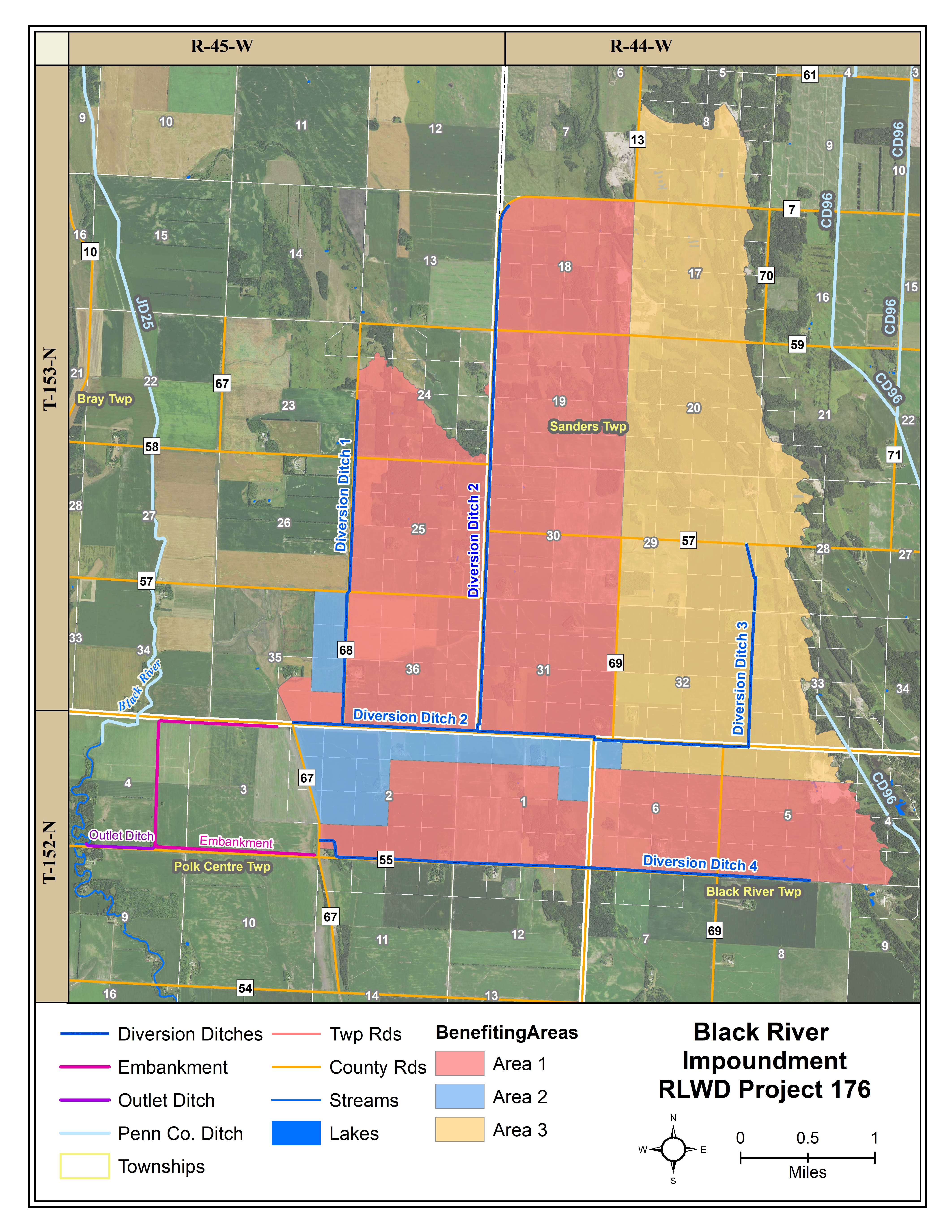
Project Location
The Black River Impoundment project (RLWD Project 176) is located in section 3 and 4 of Polk Centre Township in Pennington County. It is approximately 9 miles west of the City of St. Hilaire and resides on the southerly property immediately adjacent to Pennington County State Aid Highway 3, just east of the Black River.
Design Considerations
The primary purpose for the project is to reduce flood damages within the Black River sub-watershed. An off-channel flood control impoundment was constructed to store floodwaters from the approximate 16.9 square mile drainage area and strategically release the floodwater when downstream channel conditions can accommodate them. The impoundment will be maintained in a dry condition when flooding is not occurring. The impoundment has a total capacity of approximately 4,064 acre-feet (4.51 inches), of which 3,162 acre-feet will be gated providing detention time of approximately 33 days if needed.
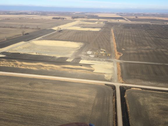
Looking North From South West Corner of Embankment
Project Components
The diking system consist of the main impoundment around the north, south, and west sides of the site, tying into natural ground on the east end. The main dike consist of approximately 3.0 miles of dike around the impoundment. The dike along the west side will be the highest approaching a maximum of 14 feet with an average of 8 to 12 feet above natural ground. The dikes along the north and south sides are highest at the west end, about 10 to 12 feet. A typical section having a 12-foot top and 4:1 exterior side slope and 5:1 interior side slope for the diking system. To maximize the drainage area and direct runoff into the site, 3 diversion ditches were constructed.

STA 63+00 Looking North
The water from the diversion ditches navigates through the impoundment site by inlet channels along the interior of the dikes in Section 3 and 4, (T152N, R45W) to the outlet in the southwest corner of the storage facility.
The outlet of the impoundment site is a gated culvert and riser and an auxiliary spillway for extreme flows. The low flow outlet is sized so that at least 85% of the gated volume will be released in 10 days or less. The auxiliary spillway (emergency spillway) is sized to protect the embankment from overtopping and is cut through natural ground on the east end of the south embankment.
The Black River Impoundment Project was awarded to R.J. Zavoral & Sons, Inc. The impoundment has been constructed and is now fully operational! The final touches to the diversion ditches will be completed in the spring of 2022. Check out the video of the project made by Houston Engineering below and read about the latest information in theBlack River Impoundment Newletter.
Functional Design Data
Feature |
Measurement |
Storage (acre-ft.) |
|---|---|---|
| Top of Dam (Total Storage) | 1023.5 Ft. msl | 4,064 (4.51 in. runoff) |
| Secondary Spillway | 1020.50 Ft. msl | -- |
| Ungated Storage to Emergency Spillway | -- | 902 (1.00 in. runoff) |
| Gated Storage | -- | 3,162 (3.51 in. runoff) |
| Drainage Area | 16.9 Sq. Mile | -- |