1W1P
One Watershed One Plan (1W1P)
The 1W1P is a statewide effort aimed to transorm the way local entities plan for resource management. The plan consolidates policies, programs and implementation strategies from existing data, studies and plans, and incorporates input from multiple planning partners to provide a single plan for management of the watershed. The plan focuses on targeted and measurable implementation efforts and lays out specific actions to manage water quantity, protect and restore water quality, natural habitat, recreational uses and drinking water sources in the watershed.
Within the Red Lake Watershed District there are five subwatershed; Red Lake River, Grand Marais, Thief River, Clearwater River and the Upper and Lower Red Lake. The Red Lake River and Grand Marais are grouped together, otherwise there is a 1W1P for each sub-watershed, totaling of 4 separate plans. Red Lake River and Thief River plans are completed while Clearwater River and the Upper and Lower Red Lake plans are currently being created. See below for more information on each plan.
Red Lake River One Watershed One Plan
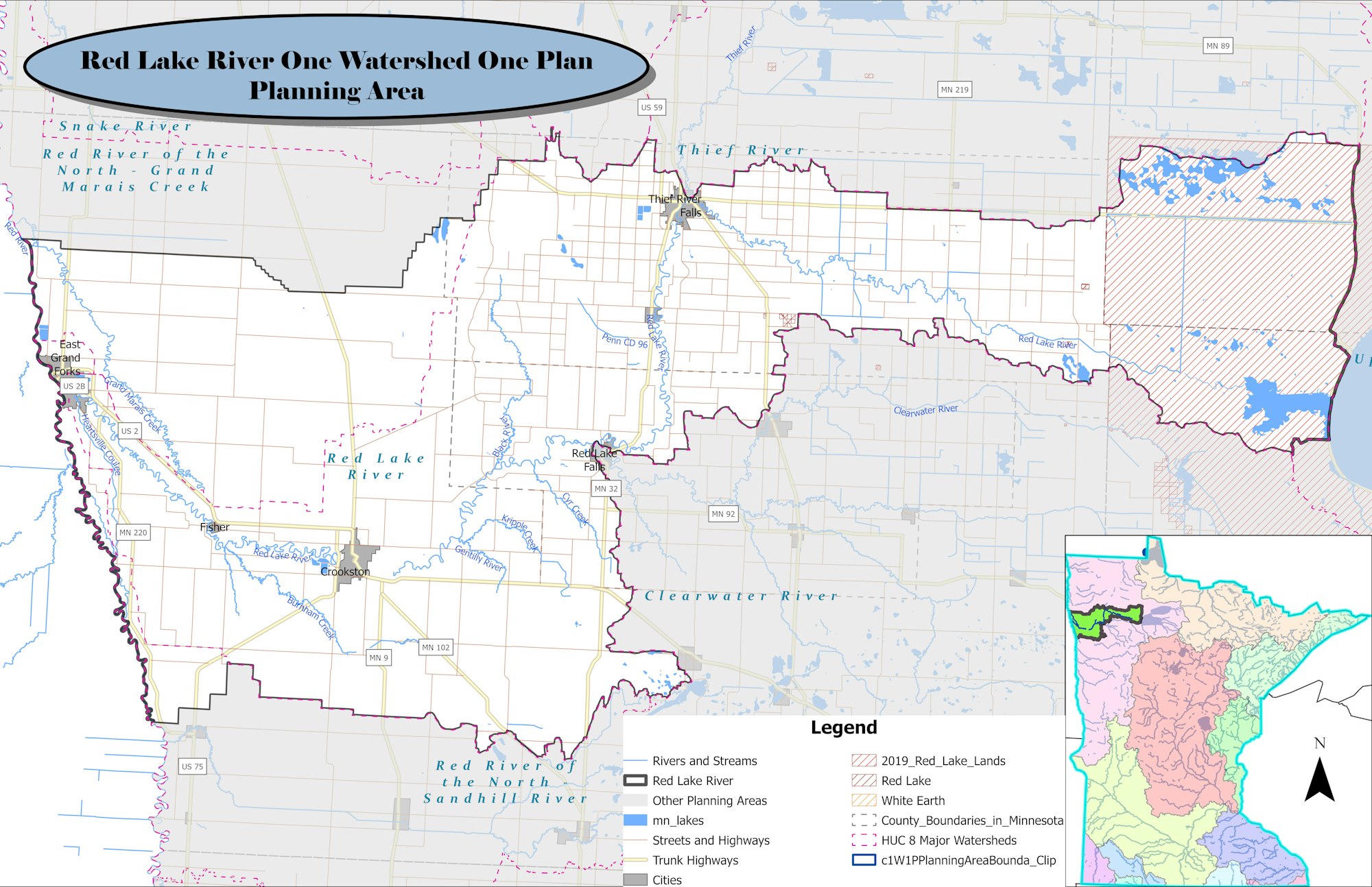
This plan was approved in 2017 and recieved its first round of funding in 2018, second round of funding in 2020, third round in 2022, and fourth round in 2023! Grade stablilization structures, water and sediment control basins, and ditch outlet stabilizations projects have been completed and more is yet to be done!
In 2014, local governments in the Red Lake River Watershed entered into a memorandum of agreement to cooperatively develop and implement a ten-year Comprehensive Watershed Management Plan. The Red Lake River Comprehensive Watershed Management Plan was one of five pilot plans throughout the state and was completed in 2017. The partnership is five years into the implementation and currently in the process of evaluating implementation efforts to:
- Evaluate the progress made towards plan goals
- Identify new data and information for incorporation into the plan
- Identify potential revisions to amend the plan
The Red Lake River Planning Group has completed a draft amendment of the comprehensive watershed management plan through the One Watershed, One Plan Program. Pennington, Red Lake, and West Polk SWCDs and the RLWD are worked with local and state partners to review and compile watershed data, discuss priority issues, and set plan goals through this amendment process. The issues identified will be used to identify projects and practices to implement in priority areas of the watershed over the next 10 years. The 60-Day plan review process is underway in early 2026, with comments from stakeholders due by April 15, 2026.
Click here for the Red Lake River 1W1P Midpoint Amendment Timeline Click here for the Red Lake River One Watershed One Plan Amended 2019- Click here to visit West Polk SWCD's website for more info
- Links to the plan and appendices can be found on the Pennington SWCD Website.
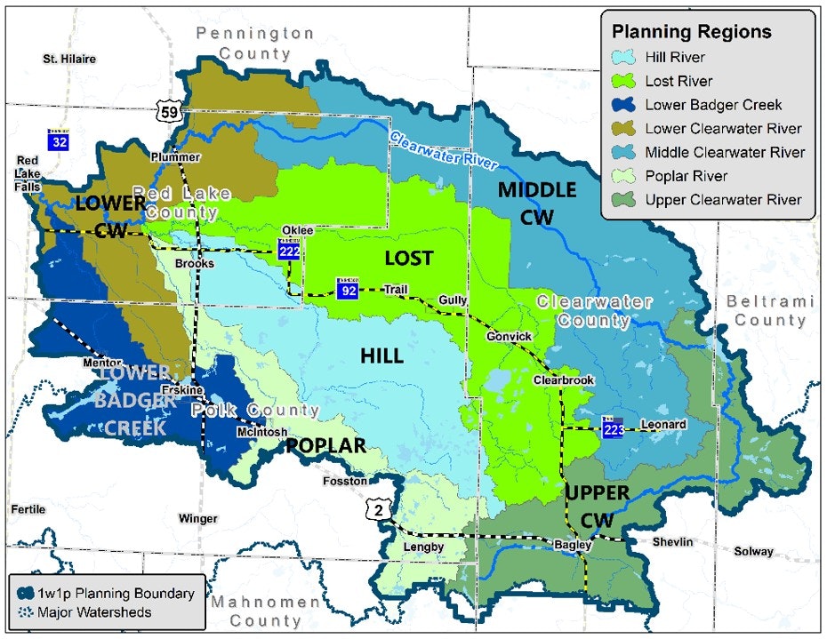
Thief River One Watershed One Plan

This plan was approved in 2020 and has received two rounds of funding (2020 and 2022). Streambank stabilizations, ditch outlet stabilizations, side water inlets, and cover crop practices are some things that have been completed or will be completed.
Click here for the Thief River One Watershed One PlanClearwater River One Watershed One Plan
This plan was approved in 2022 and implementation began with the first round of funding in 2023!
Click here for the Clearwater River One Watershed One Plan 2022- Click here to visit the Clearwater River 1W1P website for more info
- Click here to visit RLWD's subwatersheds website for more info
Upper and Lower Red Lake One Watershed One Plan

The Upper/Lower Red Lakes Comprehensive Watershed Management Plan was completed in 2025. The Beltrami SWCD is coordinating the implementation of this plan. The Red Lake Nation is also a partner i
- Click here to visit RLWD's subwatersheds website for more info or
- Click here to visit Red Lake Department of Natural Resources website for more info